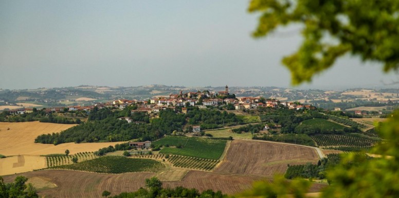
Da Castel San Pietro al Bric del Lupo
From Castel San Pietro along the ridge of the hills overlooking the Vercelli plain in the Po and Orba River Park with stunning views of Mount Rosa. Return is predominantly off-road through vine planted hills. Starting from the cemetry carpark of Castel San Pietro, turn right onto tarmac following the directions for Rocca delle Donne. We do not recommend turning immediately left to shorten the route; apart from the fact that you would go down a one-way street in the opposite direction, you would miss the spectacular view of the Alps and the surrounding lowland. Follow the only road that goes around the small village until the directions "Fiume Po" and "Cantavenna". A fun non-demanding descent begins for 1.4 km; having arrived at the information totem of the Po and Orba River Park, turn left uphill on dirt road for 2 km and on tarmac for 750m. Turning right you reach the square of Cantavenna; staying on the right take the road after the grocery store next to the Church to see the view of the lowland and Alps. Having returned to the square continue, leaving the Cantina Sociale (Wine Cooperative) on the right and the grocery store on the left. Continuing on tarmac uphill, having reached a left elbow bend, we leave it and go straight on in the direction of Pozzengo for about 3.4 km to arrive opposite the Church of Santa Maria del Carmine, which features the altar in the window. Continue for 80 m; turn left taking the dirt road downhill to the valley bottom. At the first dirt road we meet turn right and, after approximately 400 m, keeping left, continue uphill and come out on tarmac, turning right. In Ilengo, cross the crossroads and go on dirt road again for 1.5 km. Turning right on tarmac you reach Zenevreto; at the crossroads beyond the road that arrives from the right you notice a small ramp with a small square. Take it and follow the dirt road uphill to reach Bric del Lupo. Continuing, BE CAREFUL of the narrow path, the two landslides to the right and of any other bikers riding downhill. Having reached the top, continue right to descend to tarmac and turn left. From here, continue until you find a crossroads for 1.3 km. Turn left and after 400 m turn right uphill following the sign for Castel San Pietro. Continue for approximately 1.8 km to the point of departure. (itinerary geomapped by Claudio Trombin)
Points of interest
Departure, arrival and municipalities crossed
15020 Camino (AL)
Alessandria
Alessandria
Information and contacts
- 15020 Camino (AL)
Castel San Pietro


