Ecco la Route 45 del Monferrato
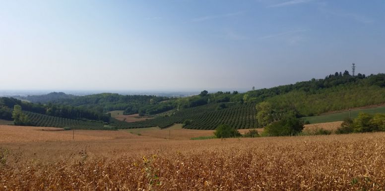
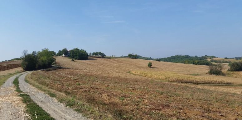
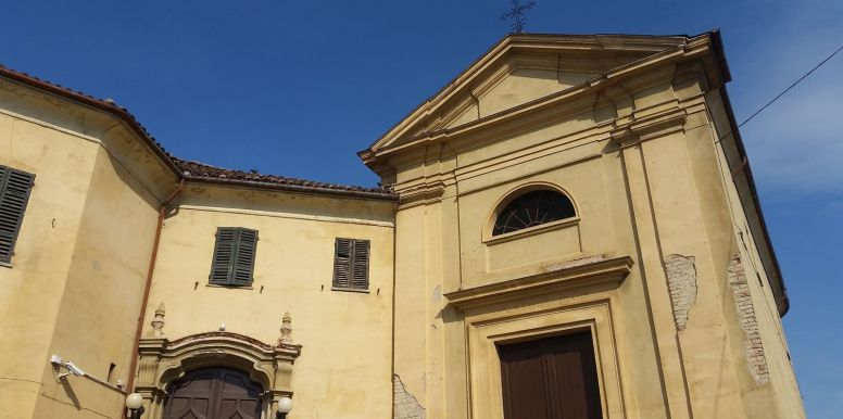
Known as Route 45, a tribute to the 45° parallel North, which crosses most of this hilly area of Monferrato (a UNESCO heritage site) and does so in 6 different points, placing the cyclists repeatedly halfway between the Equator and the North Pole! The circular route is a balanced mix of fast uphill’s and downhills without lacking cultural elements, natural features and striking landscapes: speaking frankly, so the circle, actually the circles close. The start of the trail is from one of the oldest buildings in San Salvatore Monferrato, namely the Palazzo Carmagnola located in the square of the same name . Following a short climb on via Prevignano, pass next to the parish church of San Martino (XV century) and then, following the tracks of the route, alongside the San Siro Church (XVI century) on the right. After about 700 meters from the start, turn left onto via Camurati where, near Villa Lingua - former headquarters of the state during the Second War of Independence - a gravel descent begins that take us to a secondary road connecting San Salvatore to Alexandria, the lowest point of the route. Within a few minutes the scenery changes dramatically, going from a city context to graveled streets, green hills and poplar trees ... the climb is right there, waiting, just around the corner, to claim its "hunger" for fatigue and its hilltop “fame” typical of Monferrato. After nearly 2 km of graveled paths immersed in nature, you return for a short stretch in the village to take a new road leading to the sanctuary of Madonna del Pozzo (3,930 km) a small oasis of peace surrounded by greenery where it is possible stop for a while to enjoy the magnificent view of the green hills sloping down to the River Po Park. Continuing on the uphill path that leads to the hamlet of Frescondino, you can admire the valley towards the river Po from one of the highest points of the whole route, just after turn left towards the hamlet of Valparolo (at 5.7400 km) crossing the first of 6 points traversed by the 45° parallel (6,080 km). The roads in this section are surrounded by farms and vineyards, and it will not be difficult to come across some tractors here and there, further demonstrating the strong agricultural and rural vocation of the local community dedicated to agriculture. Leaving the hamlet of Valparolo after a long asphalted downhill surrounded by countryside and on reaching the provincial road towards Valenza (Km 7,670), turn first right and after 200 meters to the left, towards the hamlet of Fosseto. After about 400 meters, a new uphill gravel road, surrounded by vineyards and spread-out fields and ordered ready to welcome us and to 9,990 km, (the height of the aqueduct sign) here is another point of the 45° parallel crossing . At the end of the gravel road, we will be ready to retake the asphalted road leading back towards the center of San Salvatore, which is the same piazza Carmagnola from where we started and where we can refresh and gather new energy for the second half of the route. From the center of the village (11,200 km) take via Panza in the direction of Casale Monferrato , passing a long walled property on the left, turn left into via Suanno, proceeding until the end of the descent. Leaving via Suanno behind, turn to the right and travel along the long stretch of road uphill, after which (12,400 km) you are in via Frascarolo (the road which connects San Salvatore Monferrato to Lu) , at the stop sign go to the left towards Lu: note that to the right of the Stop is another votive chapel. The next 500 meters in the direction of Lu, is along the crest of the hill, a real watershed between the South side - towards the plains of Alessandria on the left - and the hills of Casale Monferrato – to the right - behind which, on clear days the chain of the Alpes-Maritimes are clearly visible. Exactly 100 meters before a beautiful orange house on the left, cycle along a long stretch in the countryside, authentic and evocative landscapes happily desolate, within which the village of Lu Monferrato forms the background along with expanses of hazelnuts on one side and vineyards on the other. After about 1100 meters, just before a farm on the left, cross the North parallel for the third time and then at a crossroads after 200 meters, turn right on to a dirt road. The panorama of the Alps and the hills, besides being incomparable, rewards any effort in getting here and after passing a small house with the Italian flag on the roof on the left, you arrive at a group of houses, namely Valdolenga, a hamlet with a strong rural character. At this point (15,400 km) we will take the steep descent to the right and after the highway underpass, turn right following it all the way to its uphill conclusion. In this last stretch of road, the 45° parallel will be crossed at 17,200 km. Once at the crest of the hill turn left and then straight ahead returning to San Salvatore Monferrato. At the first stop (km 19.00) note on the left the presence of the old Santa Croce hospital (15th Century) and turn left towards Casale Monferrato and then right (after 100 meters), towards Via Sottotorre , arriving at the park of the famous paleolithic tower (15th Century) with the characteristic pear-shaped hole, follow the vertical signage. In the park facilities of the tower, in addition to seeing the landscape from another point of view, you can gather strength and fill water bottles to prepare for the final stunning stretch of the route. Once you reach the top of the hill, where the historic tower is located, take the only asphalted road which departs behind the tower to return (after about 400 meters) again onto the original route and at the end of the descent (km 19,900 ) turn left onto a gravel stretch, in strada Molinara. The route continues straight and at 300 meters from the beginning of strada Molinara cross the 45° parallel again for the fifth time. Nearby, on the left is a well-known Agriturismo, follow the natural continuation of the gravel road downhill to the right. This last stretch of gravel road (and then dirt road) in the middle of nature ends after almost 2 km at another low point of the route and once we reach the asphalted road again (21,80 km) turn left towards the hamlet of Fosseto. Taking an additional left turn, after 600 meters follow the normal road signs for San Salvatore Monferrato, a village just before the final stop (in the center of the village) after almost 2.5 km, not before having crossed the 45 ° Parallel for the last time at 24,200 km. By Ivan Reitano
Points of interest
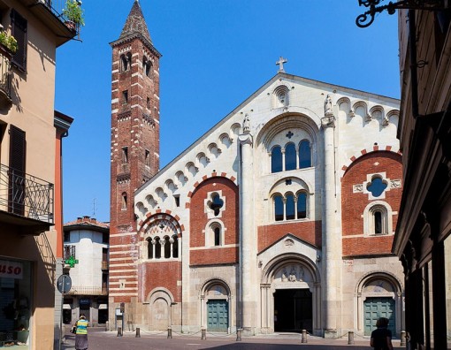
Stages of the route and points of interest: San Salvatore Monferrato: San Martino Church (XV cent.), San Siro Church (XVI cent.) ; Palazzo Cavalli di . Germano (XVIII cent.), Palazzo Carmagnola (XV cent.); Torre dei paleologi (XV cent.); Sanctuary of Madonna del Pozzo (XVII cent.); Santa Croce Hospital(XV cent.) Frescondino; Valparolo, Valdolenga. Notes on the signage: those present are true noted on the site Piemeontebike.eu and it is always advisable to use a guide who knows the area well and who is aware of any changes to the route that may have varied since Piemontebike.eu carried out verification surveys and updates. Advice: Please note: wear your helmet at all times, even when not obligatory. Before setting off, make sure you inform someone of your intended route. If possible, take a GPS device, mobile phone and a bottle of water with you and if it is a long distance route, take snacks. Wear suitable clothing, preferably layers, and make sure you have a waterproof jacket. Always wear padded shorts. Comfort is essential if you are to enjoy the journey to the full. Stages of the route and points of interest: San Salvatore Monferrato: San Martino Church (XV cent.), San Siro Church (XVI cent.) ; Palazzo Cavalli di . Germano (XVIII cent.), Palazzo Carmagnola (XV cent.); Torre dei paleologi (XV cent.); Sanctuary of Madonna del Pozzo (XVII cent.); Santa Croce Hospital(XV cent.) Frescondino; Valparolo, Valdolenga.
Departure, arrival and municipalities crossed
Departure and arrivalpiazza carmagnola15046 San Salvatore Monferrato (AL)
Alessandria
Note
The circuit is 24,90 Km reaches a maximum altitude of 247 meters, a minimum of 123 meters, total ascent: 561 meters, 559 meters difference in height
Information and contacts
piazza carmagnola - 15046 San Salvatore Monferrato (AL)


